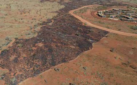
Prescribed burning at FMG’s Christmas Creek site. Source: FMG
Undertakes ‘fire scar’ mapping.
Fortescue Metals Group (FMG) has developed a remote sensing tool to protect its staff and assets in the Pilbara by understanding the past impact and incidence of bushfires.
The ASX-listed miner’s health and safety team partnered with its geospatial services division to develop the new capability using multi-spectral satellite data fed into complex algorithms to identify traces of previous fires.
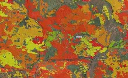
By analysing and identifying vegetation that had previously been burnt, FMG was able to create ‘fire scar’ mapping that showed the age and amount of regrowth since previous fires, the company said in its annual sustainability report [pdf].

FMG’s fire scar map. Image: ITNews
‘Fuel age’ data, as FMG refers to it, can be used to determine the potential severity of a bushfire when combined with other data including the vegetation type, density and surrounding terrain.
It can be used to map out the best places to conduct low-intensity prescribed burns to reduce the amount of combustible material and create a more varied landscape of fuel ages.
The Australian National University’s Institute for Space is working on a similar project where a constellation of mini-satellites is set up to gather data to help inform emergency agencies such as the NSW Rural Fire Service on how they can manage fuel loads to try and prevent a repeat of the previous fire season’s unprecedented 240-day long run of bushfires.
FMG has already been able to act on insights gathered from the project, undertaking a prescribed burn near the accommodation village at its Christmas Creek mine earlier this year.
In addition to reducing the risk to workers’ safety and the company’s assets, the ongoing bushfire risk management program is set to minimise disruption at the remote facilities.
https://www.itnews.com.au/news/fortescue-manages-bushfire-threat-from-space-552263
Matt Johnston


